Statistics and Catastrophe
80 years ago Adolf Eichmann was busy preparing a list detailing the number of Jews living in various territories to be presented in the meeting at the lake that became known as the “Wannsee Conference”. Teaming up with partners from the European Network of Remembrance and Solidarity we are currently developing an interactive tool that will not only question Eichmann’s numbers and explain how the list was made, but also highlight the catastrophes – the humans – that were hidden behind the statistics drawn up for the Wannsee Conference.
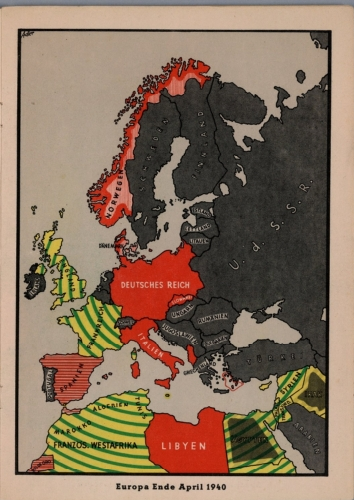
In so doing we are currently looking at historical maps and found the atlas “Der Krieg 1939/41” in our wonderful library. In a certain colonial attire, the maps include Northern Africa into Europe. Author of the atlas that was printed in Munich, was Giselher Wirsing. Wirsing was an officer of the security service (SD) of the SS who also worked at the Institut zur Erforschung der Judenfrage and later for the high circulation weekly “Signal”.
After liberation (and a minor sentence in a trial) Wirsing became editor in chief of the influential German weekly “Christ und Welt” and a fierce opponent of Joseph Wulf’s endeavours to found a research institute in the Villa at the Wannsee we are currently working in.
Although Wirsing died in 1975, his work and ideas were not forgotten. “Der Krieg 1939/41” was re-printed in 2008 by the Melchior Verlag and in 1998 by Pour le Mérite. Especially the latter publishing house is known for its revisionist program.